You saved the photo on Instagram. You flew there. And then you stood at the landmark wondering where, exactly, that shot was taken from. The location tag points at the building. The photo was taken from a bridge two streets away. Photo spot apps exist to close that gap, and they go about it very differently.
We make one of the apps on this list, TourTour, so read our placement with that in mind. The others are genuinely good tools, several of them built by and for photographers, and depending on how you shoot they may fit you better. Here is the honest map of the field.
Quick comparison
| App | Price | Coverage | What it maps | Best for |
|---|---|---|---|---|
| TourTour | One time per city | 117 destinations worldwide | Vantage points and hidden gems for every landmark, offline | Travelers who want the walk and the photos in one app |
| Explorest | Free tier, subscription | Major cities and nature spots | Curated positions by pro photographers | Photographers chasing portfolio shots |
| Locationscout | Free, optional premium | Worldwide, community driven | Member submitted spots with settings notes | Landscape photographers planning trips |
| PIXEO | Free tier, subscription | Wide, strongest in North America and Europe | Community photo spot map | Browsing spots around you |
| PhotoPills | One time purchase | Anywhere | Sun, moon and Milky Way over a spot you choose | Planning the light, not finding the spot |
| ShotHotspot | Free website | Worldwide, aggregated | Spots mined from photo sharing sites | Quick free research |
| Instagram + Google Maps | Free | Everywhere | Location tags and saved posts | DIY research if you have the patience |
The full reviews
1. TourTour
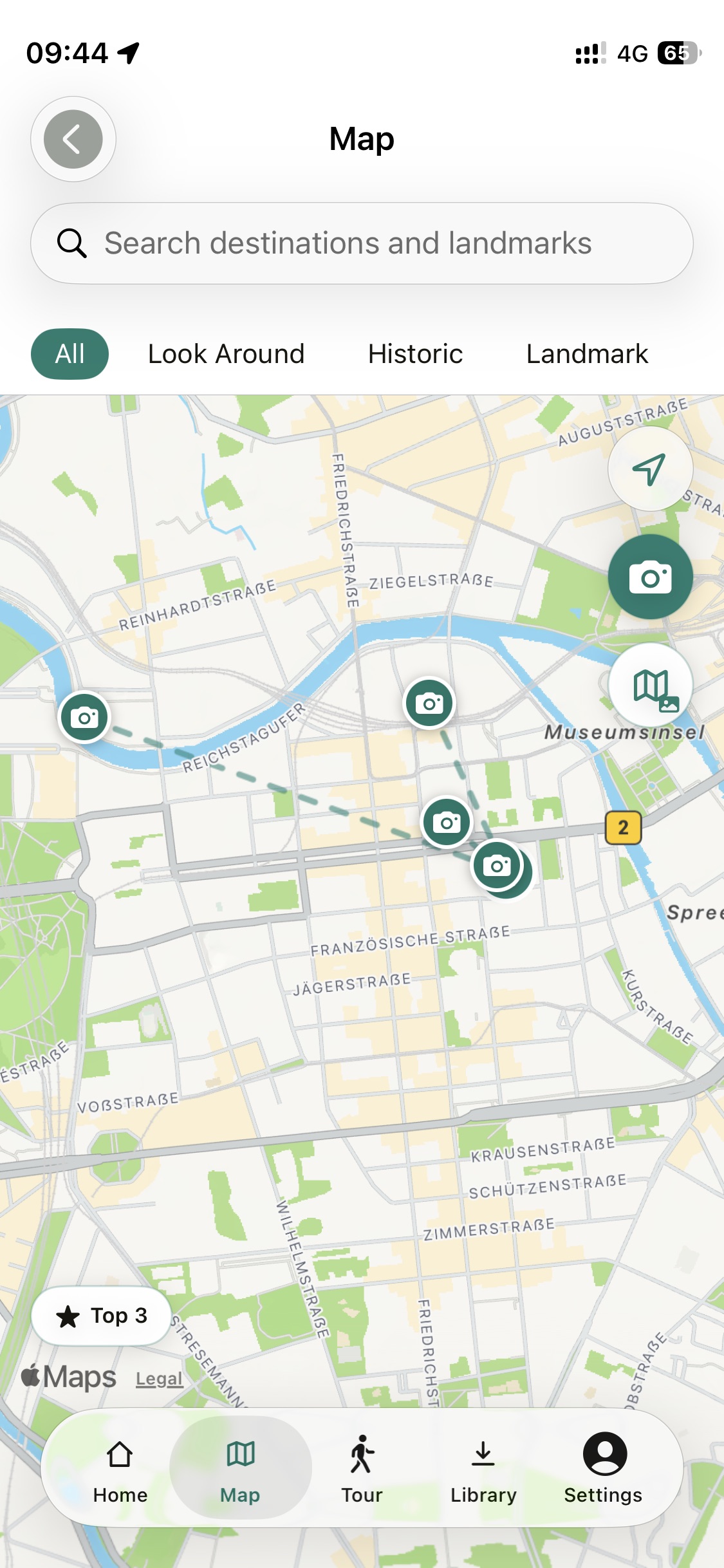
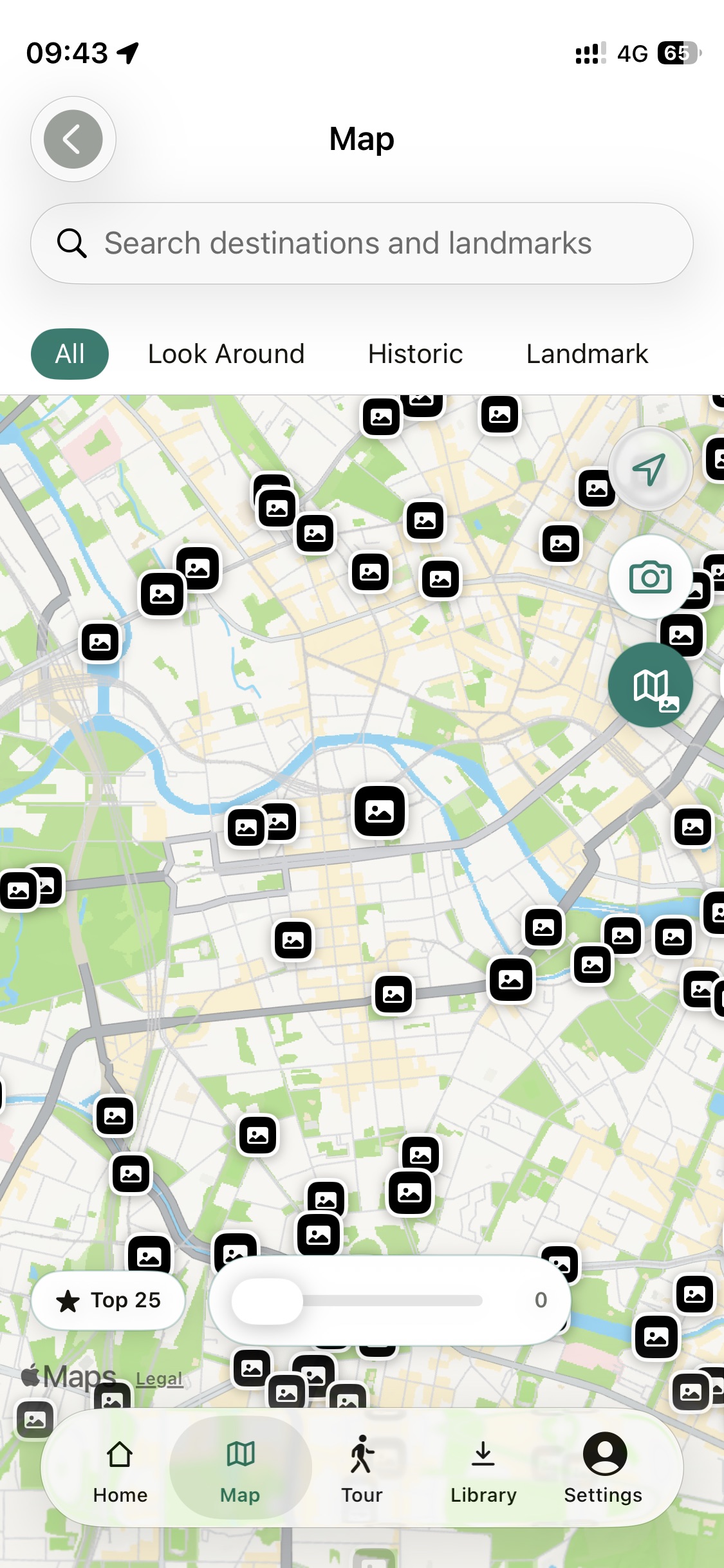
TourTour is an audio tour guide app that also maps the photography. For every landmark on a tour, the map carries photo spot pins for the vantage points where photographers actually stood, each with the direction to face. The famous angle is there, and so are the hidden gems, the quieter positions a block away that most visitors never find. A quality filter lets you show just the top spots in a city or dig into the long tail.
The reason it ranks first for travelers, rather than working photographers, is that the photo spots live inside the trip you are already taking. You walk a narrated route, the stories play in your ear, and when you approach a landmark the good angles are already on the same offline map. No signal needed, no separate research evening before the flight. It covers 117 destinations across Europe, Asia, the Americas, Africa and Oceania.
Honest limits. The spots are computed positions, not photographer written guides. You will not get a paragraph about which lens to bring, the way curated platforms provide. And if you only want photography and no tour, a dedicated photo platform may be all you need.
Strengths. Vantage points and hidden gems for every landmark, offline, direction to face, part of the tour you are already walking.
Trade offs. No lens and settings advice, travel first rather than photography first.
2. Explorest
Explorest is the premium curated option. Professional photographers publish exact shooting positions with the composition, and the app walks you to the coordinates. When a location is covered, the quality of guidance is the best in this list, and photographers building a portfolio around known views love it for a reason.
The limit is the model. Curation means coverage grows slowly and clusters around photogenic cities and nature icons, and the good stuff sits behind a subscription.
Strengths. Exact pro positions, beautiful curation, strong for portfolio shots.
Trade offs. Coverage gaps, subscription, needs a connection for browsing.
3. Locationscout
Locationscout is the community workhorse, a large member built database of photography locations with notes on access, best time of day, and sample shots. For landscape photographers planning a trip, browsing what the community has found in a region is genuinely productive, and the free tier is usable.
As with any community platform, density varies. Iceland is mapped to death, a mid sized Asian city may have a handful of pins. Quality of notes depends on who submitted them.
Strengths. Big free database, practical notes, good trip planning tools.
Trade offs. Uneven density, browsing needs a connection, photography first rather than travel first.
4. PIXEO
PIXEO puts community photo spots on a clean map and shows you what is around you. It is pleasant for serendipity, standing in a new neighborhood and seeing three marked viewpoints within walking distance. The catalog is strongest in North America and Europe.
Like Locationscout it depends on member submissions, so depth swings by region, and the better features sit in the paid tier.
Strengths. Clean map browsing, good around-you discovery.
Trade offs. Regional gaps, subscription for the full experience.
5. PhotoPills
PhotoPills is not a photo spot finder and does not pretend to be. It answers the other question, when to shoot. Sun and moon position, golden hour, Milky Way alignment, all projected over any spot you choose. Photographers pair it with one of the location apps above, find the spot there, plan the light here.
Strengths. The reference app for light planning, one time purchase.
Trade offs. Finds no spots for you, real learning curve.
6. ShotHotspot
ShotHotspot is a free website that mines photo sharing platforms to guess where good photography locations are. As free research it can surface areas worth a look, and costs nothing to try. The interface is dated and the hit rate is mixed, you will sift.
Strengths. Free, worldwide, zero commitment.
Trade offs. Dated, noisy results, no mobile experience to speak of.
7. Instagram and Google Maps, the DIY route
The default workflow. Save posts, open the location tag, cross reference Google Maps photos, drop a pin, repeat. It works, it is free, and every serious traveler has done it. The cost is the evening it takes per city, and the location tag problem never goes away. The tag marks the landmark. The photo was taken from somewhere else, and finding that somewhere else is exactly the work the apps above exist to remove.
Strengths. Free, unlimited, you learn the city while researching.
Trade offs. Slow, tags point at the wrong place, everything needs a connection.
Category winners
There is no single best app. There is only the best one for how you shoot.
Best for travelers. TourTour. The photo spots live on the same offline map as the tour you are already walking, vantage points and hidden gems included.
Best for portfolio photographers. Explorest, where the curated positions are worth the subscription in covered cities.
Best free database. Locationscout, with ShotHotspot as the zero effort fallback.
Best for planning the light. PhotoPills, alongside whichever location app found you the spot.
Frequently asked questions
How do I find the exact spot where an Instagram photo was taken?
Location tags on Instagram usually point at the landmark, not the vantage point the photo was taken from. Photo spot apps solve this by mapping the shooting positions themselves. TourTour marks the vantage points and the direction to face for every landmark on its tour map, and community databases like Locationscout and PIXEO collect member submitted positions.
Which photo spot apps work offline?
TourTour stores its photo spots offline together with the rest of the city, so the pins work with no signal. Most community photo spot platforms need a connection to browse their databases, so check before you travel. Our guide to using tours offline covers the same principle for audio.
What is the difference between a photo spot app and a photo planning app?
A photo spot app answers where to stand. A planning app like PhotoPills answers when to shoot, with sun, moon and Milky Way positions for a spot you already chose. Serious photographers often use one of each.